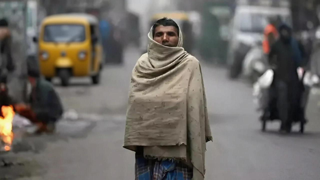
Even as Cyclone Montha lost its cyclonic strength over coastal Andhra Pradesh on 30 October 2025, its lingering moisture triggered a cascade of emergency alerts across eastern and central India. The India Meteorological Department (IMD) issued orange alerts for heavy to very heavy rainfall in five states—Telangana, Gujarat, West Bengal, Bihar, and Andhra Pradesh—despite the storm’s structural collapse. What’s remarkable isn’t just the rainfall, but the fact that a system once off the coast is now drenching places like Darjeeling and Bihar, regions rarely hit this hard by Bay of Bengal cyclones. The twist? It’s not the wind anymore—it’s the water. And it’s coming down hard.
How a Dying Cyclone Still Packs a Punch
By 10:34 AM UTC on 30 October, Cyclone Montha had officially downgraded to a deep depression, then further to a well-marked low-pressure area, according to both the IMD and The Statesman. But here’s the thing: storms don’t vanish when they weaken. They transform. The remnants of Cyclone Montha—still saturated with moisture from the Bay of Bengal—began acting like a slow-moving sponge, dragging rain inland. The IMD’s analysis confirmed this: its counterclockwise circulation pulled in humid air, which then collided with cooler, drier air over central India, triggering intense, prolonged rainfall. No new wind, no storm surge—but the rainfall? That’s still dangerous.
Where the Rain Is Falling—and Why
In West Bengal, the pattern was precise. On Thursday, rain moved inland to Purulia, Birbhum, and Murshidabad. Friday? A full orange alert for Darjeeling, Kalimpong, Jalpaiguri, Cooch Behar, and Alipurduar. The IMD warned of landslides in these hilly districts, where soil is already saturated. Meanwhile, Andhra Pradesh faced a 12-district orange alert, including Srikakulam, Krishna, and West Godavari. Coastal residents were told to brace for tidal surges and waterlogging—remnants of a storm that no longer qualifies as a cyclone.
Political Response: Emergency Meetings and Local Action
While the IMD issued forecasts, political leaders scrambled to respond. In Andhra Pradesh, YS Jagan Mohan Reddy, president of the Yuvajana Sramika Rythu Congress Party (YSRCP) and former chief minister, called an emergency meeting on 30 October with district presidents to coordinate relief. His party, headquartered in Vijayawada, is the dominant force in the state’s disaster response. In Bihar, where the IMD had no district-level forecasts yet, officials were on standby. “We’re not waiting for a direct hit,” said one Bihar disaster official anonymously. “We’re preparing for the worst kind of rain—the kind that sneaks in after the storm is gone.”
What Makes This Different From Past Storms
Cyclone Montha was the second named storm of the 2025 North Indian Ocean season, following Cyclone Remal in May. But its path was unusual. Most cyclones that make landfall in Andhra Pradesh move north-northeast toward Odisha or Bangladesh. This one turned west-northwest, dragging moisture into Bihar—a state that rarely sees such concentrated rainfall from coastal cyclones. Historical data shows Bihar gets most of its monsoon rain from the Bay of Bengal branch, but direct cyclone impacts are rare. This event, experts say, may be a sign of shifting patterns. “We’re seeing more systems stall or veer unexpectedly,” said Dr. M. Mohapatra, Director General of Meteorology at the IMD, in a briefing from their Kolkata regional center. “Climate change isn’t just making storms stronger. It’s making them stranger.”

What’s Next? The Timeline Unfolds
The IMD projected gradual improvement. By Saturday, 1 November, rain in West Bengal would taper to moderate levels. Sunday, 2 November, would be partly cloudy. By Monday, 3 November, the state would be dry. In Bihar, residual showers were expected through 1 November, with no further alerts beyond that. The low-pressure system was forecast to dissipate entirely by 2 November. The IMD’s next bulletin was scheduled for 5:00 PM IST on 30 October, with special focus on Bihar, where data remained sparse.
Why This Matters Beyond the Rain
There are no casualty figures yet. No exact rainfall totals in millimeters. But the IMD defined “very heavy rainfall” as 64.5–115.5 mm in 24 hours—enough to overwhelm drainage, flood roads, and trigger landslides in fragile terrain. In Darjeeling, where roads are narrow and landslides common, even 50 mm can shut down transport for days. In Andhra Pradesh, coastal villages near Krishna and Guntur districts could see saltwater intrusion into farmland. And in Bihar, where flood infrastructure is outdated, even moderate rain can become a crisis. This isn’t just weather. It’s a stress test for India’s disaster response systems.
Frequently Asked Questions
How much rain is considered ‘very heavy’ by the IMD?
The India Meteorological Department classifies ‘very heavy rainfall’ as 64.5 to 115.5 millimeters in a 24-hour period. That’s enough to cause urban flooding, disrupt transportation, and trigger landslides in hilly regions like Darjeeling and Kalimpong. For context, most cities in India receive about 100–150 mm of rain over an entire monsoon month—so this level of rain can fall in less than a day.
Why is Bihar being affected when cyclones usually hit the east coast?
Cyclone Montha took an unusual west-northwest path after landfall in Andhra Pradesh, pulling moisture from the Bay of Bengal directly into Bihar. Historically, Bihar receives monsoon rain from the broader seasonal system, not direct cyclone remnants. This deviation suggests changing atmospheric patterns—possibly linked to warming sea surface temperatures that alter cyclone tracks. It’s a warning sign for regions previously considered low-risk.
What role did YS Jagan Mohan Reddy play in the response?
As president of the YSRCP and former chief minister of Andhra Pradesh, YS Jagan Mohan Reddy convened emergency meetings with district leaders on 30 October to assess damage and coordinate relief. Though not a government official at the time, his party controls the state’s administrative machinery, making him a key figure in mobilizing resources. His involvement highlights how regional political leaders often fill gaps in state disaster response.
Are there any long-term risks from this event?
Yes. Coastal districts in Andhra Pradesh risk saltwater contamination of agricultural land, especially in Krishna and Guntur. In North Bengal, repeated landslides could destabilize hillside communities and damage critical infrastructure like the Darjeeling Himalayan Railway. Experts warn that if such unusual cyclone paths become more frequent, India may need to upgrade flood and landslide preparedness in states like Bihar and Gujarat, which aren’t traditionally designed for such impacts.
When will the weather fully clear up?
The IMD forecasted that West Bengal would see partly cloudy skies by 2 November and completely dry conditions by 3 November. Bihar’s residual rainfall was expected to end by 1 November. The low-pressure system itself was projected to dissipate entirely by 2 November. However, the lingering moisture could still trigger isolated showers in parts of eastern Madhya Pradesh and Chhattisgarh through 4 November, though no alerts were issued for those areas.
What’s the significance of the IMD’s Kolkata center in this event?
The Regional Meteorological Centre in Kolkata is the primary hub for monitoring Bay of Bengal cyclones. It issued all forecasts for this event, using satellite data, radar networks, and ground observations. Dr. M. Mohapatra, the IMD’s Director General, operates from New Delhi, but operational decisions—like issuing district-level alerts—come from Kolkata. Its proximity to the cyclone’s origin gives it critical advantage in early warning accuracy.